Derby and Sandiacre Canal - Draycott
Introduction
The photograph on this page of Derby and Sandiacre Canal - Draycott by Mike Bardill as part of the Geograph project.
The Geograph project started in 2005 with the aim of publishing, organising and preserving representative images for every square kilometre of Great Britain, Ireland and the Isle of Man.

There are currently over 7.5m images from over 14,400 individuals and you can help contribute to the project by visiting https://www.geograph.org.uk
Derby and Sandiacre Canal - Draycott
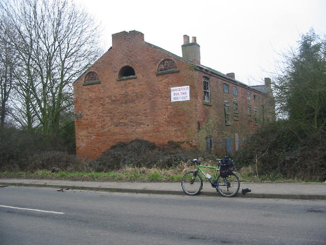
Image: © Mike Bardill Taken: 5 Feb 2006
These derelict buildings stand next to the Derby and Sandiacre Canal at Draycott. The canal was filled in along this part of the route but it has recently been dug out as part of a flood alleviation scheme for the nearby railway line.
Images are licensed for reuse under creativecommons.org/licenses/by-sa/2.0
Image Location
Latitude
52.901629
Longitude
-1.344337