Kensworth Quarry - deepest level
Introduction
The photograph on this page of Kensworth Quarry - deepest level by Rob Farrow as part of the Geograph project.
The Geograph project started in 2005 with the aim of publishing, organising and preserving representative images for every square kilometre of Great Britain, Ireland and the Isle of Man.

There are currently over 7.5m images from over 14,400 individuals and you can help contribute to the project by visiting https://www.geograph.org.uk
Kensworth Quarry - deepest level
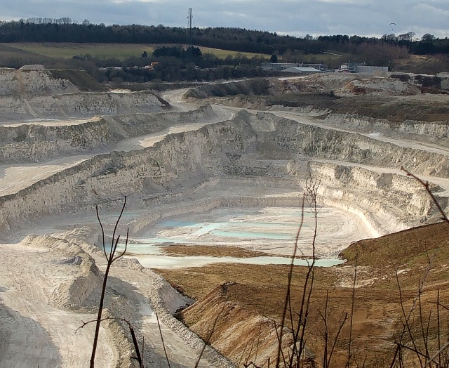
Image: © Rob Farrow Taken: 22 Feb 2009
This view of Image] focuses on the deepest level of the quarry where water has collected in eau-de-Nil pools. Some of the industry associated with the workings can be seen at a much higher level beyond the pit. Spot the parascender top right. Note - the prominent mast top centre is similar to the one seen in close-up here Image] but is I think the one at TL01441960 [Edit Dec 2010] I am obliged to Dylan Moore who tells me that there is a pipeline directly from this quarry taking chalk slurry all the way to a cement processing plant in Rugby, a Geograph photo of which can be seen here Image]
Images are licensed for reuse under creativecommons.org/licenses/by-sa/2.0
Image Location
Latitude
51.86739
Longitude
-0.514188