Rockley Furnace
Introduction
The photograph on this page of Rockley Furnace by Chris Yeates as part of the Geograph project.
The Geograph project started in 2005 with the aim of publishing, organising and preserving representative images for every square kilometre of Great Britain, Ireland and the Isle of Man.

There are currently over 7.5m images from over 14,400 individuals and you can help contribute to the project by visiting https://www.geograph.org.uk
Rockley Furnace
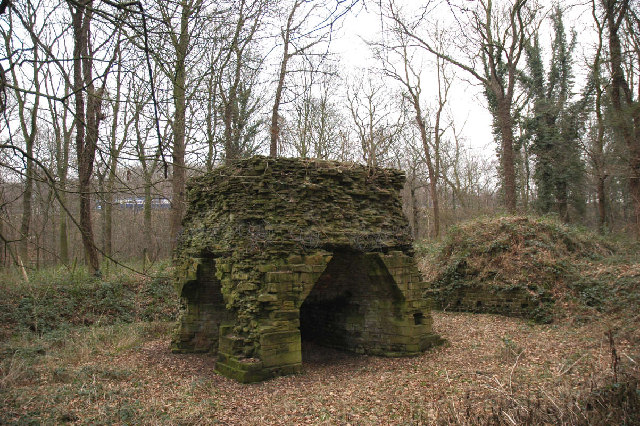
Image: © Chris Yeates Taken: 4 Feb 2006
This nationally-important piece of industrial archaeology, which lies close to the M1, was built between 1698 and 1704 to smelt the local iron ore. It was worked until the 1740s to make ‘pigs’ of cast iron. The furnace used charcoal from the local woods as fuel. It may have also been used later in the 18th century using coke as a fuel. What survives is the stack with an inner lining of heat resisting sandstone blocks, the hearth itself and most of the dressed stone outer facings have gone. To the south side is the charging bank which was linked to the furnace top by a bridge.
Images are licensed for reuse under creativecommons.org/licenses/by-sa/2.0
Image Location


Leaflet Map data © OpenStreetMap
Latitude
53.515397
Longitude
-1.491744