Hazard Quarry
Introduction
The photograph on this page of Hazard Quarry by Derek Harper as part of the Geograph project.
The Geograph project started in 2005 with the aim of publishing, organising and preserving representative images for every square kilometre of Great Britain, Ireland and the Isle of Man.

There are currently over 7.5m images from over 14,400 individuals and you can help contribute to the project by visiting https://www.geograph.org.uk
Hazard Quarry
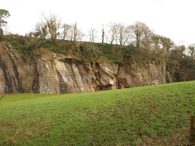
Image: © Derek Harper Taken: 12 Feb 2009
Right beside Image, and described in detail at http://www.devon.gov.uk/geo-HZQ.pdf . "Medium sized limestone quarry. 200m long face and some smaller exposures. Quarry floor infilled and grassed over. A County Geological Site ... The quarry exposes a range of interesting geological features. The association of the quarry with the original lime kilns is a feature of historical interest. The rocks present are limestones, overlain by volcanics forming a 30m high face. Fossil corals and stromatoporoids are present at the base. Small caves and other solution features are preserved." The face has been used for climbing in the past.
Images are licensed for reuse under creativecommons.org/licenses/by-sa/2.0
Image Location
Latitude
50.418531
Longitude
-3.753814