Lime kilns near Hazard Quarry
Introduction
The photograph on this page of Lime kilns near Hazard Quarry by Derek Harper as part of the Geograph project.
The Geograph project started in 2005 with the aim of publishing, organising and preserving representative images for every square kilometre of Great Britain, Ireland and the Isle of Man.

There are currently over 7.5m images from over 14,400 individuals and you can help contribute to the project by visiting https://www.geograph.org.uk
Lime kilns near Hazard Quarry
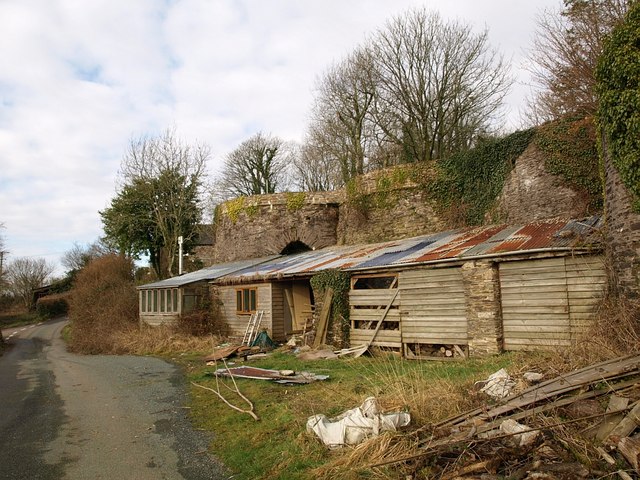
Image: © Derek Harper Taken: 12 Feb 2009
A row of three kilns by the lane between Langford Farm and Hazard. From http://www.imagesofengland.org.uk/Details/Default.aspx?id=101272&mode=adv : "the kilns are situated immediately south of Hazard quarry and are built into a bank to allow top loading from the rear. These kilns are especially interesting since one is a dated example {1789}. The nearby Hazard Cottage, originally a pair of cottages, was probably built to house quarrymen or lime burners. The cottage is dated 1792 and is nearly contemporary with the kilns."
Images are licensed for reuse under creativecommons.org/licenses/by-sa/2.0
Image Location
Latitude
50.41843
Longitude
-3.754514