Fleur de Lis Inn
Introduction
The photograph on this page of Fleur de Lis Inn by Nigel Mykura as part of the Geograph project.
The Geograph project started in 2005 with the aim of publishing, organising and preserving representative images for every square kilometre of Great Britain, Ireland and the Isle of Man.

There are currently over 7.5m images from over 14,400 individuals and you can help contribute to the project by visiting https://www.geograph.org.uk
Fleur de Lis Inn
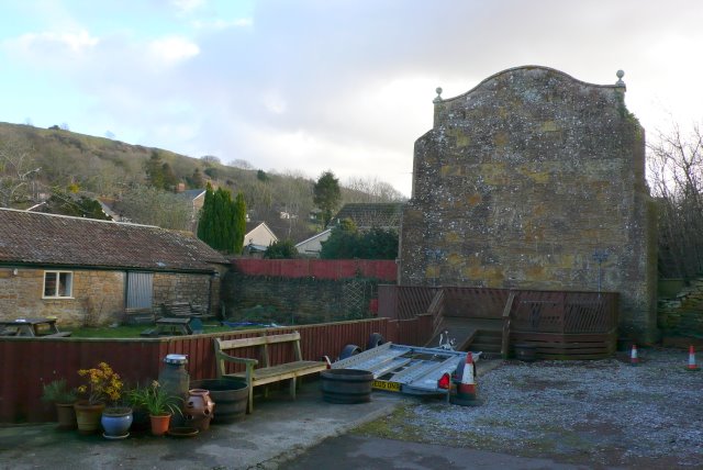
Image: © Nigel Mykura Taken: 24 Jan 2009
This shows the back yard of the inn with the fives wall on the right, the skittle alley on the left and in the background Ham Hill which dominates the village and the local countryside.
Images are licensed for reuse under creativecommons.org/licenses/by-sa/2.0
Image Location
Latitude
50.952357
Longitude
-2.750485