A pile of rubble
Introduction
The photograph on this page of A pile of rubble by Alan Murray-Rust as part of the Geograph project.
The Geograph project started in 2005 with the aim of publishing, organising and preserving representative images for every square kilometre of Great Britain, Ireland and the Isle of Man.

There are currently over 7.5m images from over 14,400 individuals and you can help contribute to the project by visiting https://www.geograph.org.uk
A pile of rubble
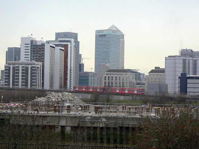
Image: © Alan Murray-Rust Taken: 12 Feb 2009
February 2009, and the title might be thought to refer to the edifices in the distance occupied by the crumbling banking industry. In fact it is referring to the heap in the foreground, the last remains of the old margarine factory in the bend of the Bow Creek. Its demise does however now open up the view of the DLR viaduct climbing up towards Blackwall.
Images are licensed for reuse under creativecommons.org/licenses/by-sa/2.0
Image Location
Latitude
51.51309
Longitude
0.006628