M3 slip roads at junction 13, Eastleigh
Introduction
The photograph on this page of M3 slip roads at junction 13, Eastleigh by Peter Facey as part of the Geograph project.
The Geograph project started in 2005 with the aim of publishing, organising and preserving representative images for every square kilometre of Great Britain, Ireland and the Isle of Man.

There are currently over 7.5m images from over 14,400 individuals and you can help contribute to the project by visiting https://www.geograph.org.uk
M3 slip roads at junction 13, Eastleigh
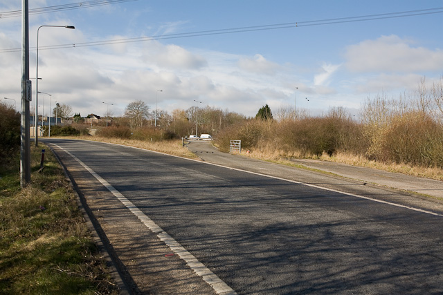
Image: © Peter Facey Taken: 13 Feb 2009
The left road is the main slip road taking Eastleigh traffic onto the M3 southbound. To the right of it is a gated road that emerges directly onto the hard shoulder of the M3. I don't know what it is for. At right is a third obsolete road which presumably was there before the M3 was built.
Images are licensed for reuse under creativecommons.org/licenses/by-sa/2.0
Image Location
Latitude
50.971988
Longitude
-1.375853