Former Crawfordsburn House, Crawfordsburn
Introduction
The photograph on this page of Former Crawfordsburn House, Crawfordsburn by Albert Bridge as part of the Geograph project.
The Geograph project started in 2005 with the aim of publishing, organising and preserving representative images for every square kilometre of Great Britain, Ireland and the Isle of Man.

There are currently over 7.5m images from over 14,400 individuals and you can help contribute to the project by visiting https://www.geograph.org.uk
Former Crawfordsburn House, Crawfordsburn
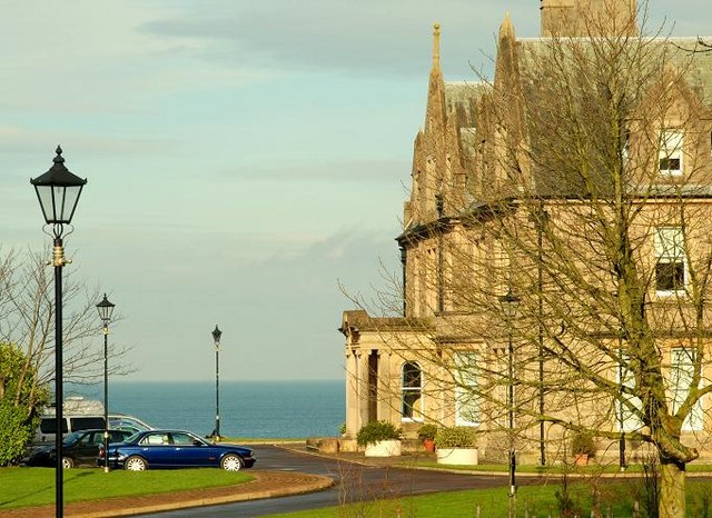
Image: © Albert Bridge Taken: 12 Feb 2009
Built in 1906 to replace one built in circa 1820 which replaced an earlier one of around 1780. Latterly it was Crawfordsburn Hospital and now (after conversion to apartments) is known as “Crawford House”. As the estate agents say “enjoys commanding views of Belfast Lough” (background). Note: taken from the grounds of Crawfordsburn Country Park. The house and grounds are well protected by the former estate wall.
Images are licensed for reuse under creativecommons.org/licenses/by-sa/2.0
Image Location
Latitude
54.66714
Longitude
-5.725002