Ashford, Kent
Introduction
The photograph on this page of Ashford, Kent by Iain Crump as part of the Geograph project.
The Geograph project started in 2005 with the aim of publishing, organising and preserving representative images for every square kilometre of Great Britain, Ireland and the Isle of Man.

There are currently over 7.5m images from over 14,400 individuals and you can help contribute to the project by visiting https://www.geograph.org.uk
Ashford, Kent
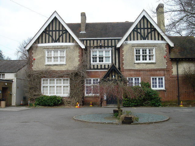
Image: © Iain Crump Taken: 17 Mar 2007
Associate House, previously and probably politically incorrectly known as 'Victory House' in the 1950's ....given that the 'victory' was over Germany (twice)... and the town is now twinned with Bad Munstereifel in Germany! The House was home to the Ashford Orchestra for many years.
Images are licensed for reuse under creativecommons.org/licenses/by-sa/2.0
Image Location
Latitude
51.153681
Longitude
0.871355