Farm building and boundary stone, Ainstable
Introduction
The photograph on this page of Farm building and boundary stone, Ainstable by Humphrey Bolton as part of the Geograph project.
The Geograph project started in 2005 with the aim of publishing, organising and preserving representative images for every square kilometre of Great Britain, Ireland and the Isle of Man.

There are currently over 7.5m images from over 14,400 individuals and you can help contribute to the project by visiting https://www.geograph.org.uk
Farm building and boundary stone, Ainstable
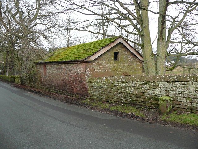
Image: © Humphrey Bolton Taken: 27 Jan 2009
The farm building looks like a small barn, in the style of estate architecture. On the side next to the road there is a round-headed window with an iron grille in the opening. The boundary stone is shown in Image
Images are licensed for reuse under creativecommons.org/licenses/by-sa/2.0
Image Location
Latitude
54.805542
Longitude
-2.76694