Stone stile at rear of churchyard, Capel
Introduction
The photograph on this page of Stone stile at rear of churchyard, Capel by Hugh Craddock as part of the Geograph project.
The Geograph project started in 2005 with the aim of publishing, organising and preserving representative images for every square kilometre of Great Britain, Ireland and the Isle of Man.

There are currently over 7.5m images from over 14,400 individuals and you can help contribute to the project by visiting https://www.geograph.org.uk
Stone stile at rear of churchyard, Capel
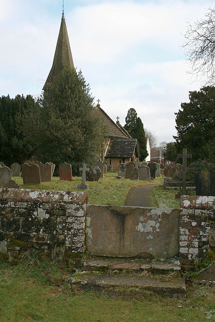
Image: © Hugh Craddock Taken: 7 Feb 2009
A stone wall was built around the churchyard during the major restoration of 1864, and this stone stile presumably dates from that time, although modelled on a traditional form. It was placed on the line of the public footpath to Ryersh Lane and Ockley village, now footpath Capel 203. It also provides access to the graveyard extension to the rear of the churchyard (although there is a gateway, rather easier to negotiate, nearby).
Images are licensed for reuse under creativecommons.org/licenses/by-sa/2.0
Image Location
Latitude
51.153783
Longitude
-0.321347