Electricity Sub Station, Oakengates
Introduction
The photograph on this page of Electricity Sub Station, Oakengates by Gordon Cragg as part of the Geograph project.
The Geograph project started in 2005 with the aim of publishing, organising and preserving representative images for every square kilometre of Great Britain, Ireland and the Isle of Man.

There are currently over 7.5m images from over 14,400 individuals and you can help contribute to the project by visiting https://www.geograph.org.uk
Electricity Sub Station, Oakengates
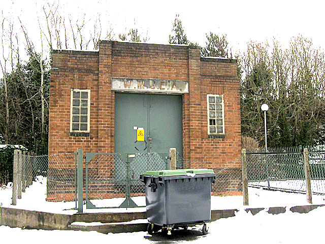
Image: © Gordon Cragg Taken: 7 Feb 2009
An old electricity sub station at Oakengates. The faint remains of the lettering on the plinth read "W.M.J.E.A." which I believe stands for "West Midland Joint Electricity Authority" and which indicates a date circa.1930s.
Images are licensed for reuse under creativecommons.org/licenses/by-sa/2.0
Image Location
Latitude
52.696275
Longitude
-2.44978