Downie Mill
Introduction
The photograph on this page of Downie Mill by Val Vannet as part of the Geograph project.
The Geograph project started in 2005 with the aim of publishing, organising and preserving representative images for every square kilometre of Great Britain, Ireland and the Isle of Man.

There are currently over 7.5m images from over 14,400 individuals and you can help contribute to the project by visiting https://www.geograph.org.uk
Downie Mill
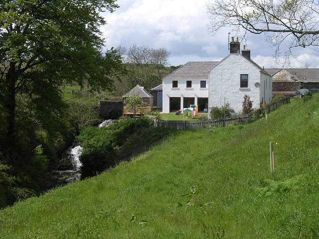
Image: © Val Vannet Taken: 21 May 2005
The Buddon Burn occupies a steep sided valley at this point on its course. Its water once powered a mill. Some of the associated buildings have now been converted into this substantial house.
Images are licensed for reuse under creativecommons.org/licenses/by-sa/2.0
Image Location


Leaflet Map data © OpenStreetMap
Latitude
56.507577
Longitude
-2.808441