Moated site, Garshall Green
Introduction
The photograph on this page of Moated site, Garshall Green by Simon Huguet as part of the Geograph project.
The Geograph project started in 2005 with the aim of publishing, organising and preserving representative images for every square kilometre of Great Britain, Ireland and the Isle of Man.

There are currently over 7.5m images from over 14,400 individuals and you can help contribute to the project by visiting https://www.geograph.org.uk
Moated site, Garshall Green
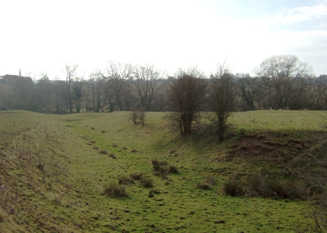
Image: © Simon Huguet Taken: 31 Jan 2009
The ditch around this former moated manor or farmstead is still very obvious and deep. Little is apparently known about its origins, which are probably C13th or C14th. The farm at Oulton House can be seen silhouetted on the skyline.
Images are licensed for reuse under creativecommons.org/licenses/by-sa/2.0
Image Location
Latitude
52.898571
Longitude
-2.053623