Brighton Road
Introduction
The photograph on this page of Brighton Road by Simon Carey as part of the Geograph project.
The Geograph project started in 2005 with the aim of publishing, organising and preserving representative images for every square kilometre of Great Britain, Ireland and the Isle of Man.

There are currently over 7.5m images from over 14,400 individuals and you can help contribute to the project by visiting https://www.geograph.org.uk
Brighton Road
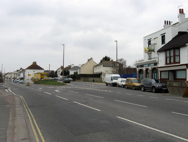
Image: © Simon Carey Taken: 1 Feb 2009
The A259 entering the central area of New Shoreham. The coast road to Brighton was constructed between 1782-89 and originally entered the town to the right up New Road. The narrowness of that road meant that by the mid 19th century what was originally the Lower Road became the main road into central New Shoreham. The Surry Arms to the right has recently been closed.
Images are licensed for reuse under creativecommons.org/licenses/by-sa/2.0
Image Location


Leaflet Map data © OpenStreetMap
Latitude
50.83253
Longitude
-0.271222