The site of the Crown & Anchor
Introduction
The photograph on this page of The site of the Crown & Anchor by Richard Croft as part of the Geograph project.
The Geograph project started in 2005 with the aim of publishing, organising and preserving representative images for every square kilometre of Great Britain, Ireland and the Isle of Man.

There are currently over 7.5m images from over 14,400 individuals and you can help contribute to the project by visiting https://www.geograph.org.uk
The site of the Crown & Anchor
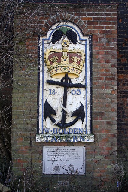
Image: © Richard Croft Taken: 3 Feb 2009
Cast Iron plaque in a brick surround attached to the wall of number 21 London Road. Formerly attached to the wall of the Crown & Anchor Tavern established in 1803, demolished in 1968 and relocated here in 1970. The plaque below reads .... The site of the Crown & Anchor Tavern, possibly known as the Rope & Anchor Tavern, was the home of George Bass, surgeon and navigator (1774-1803) who discovered Bass Strait and played a significant part in the history of Tasmania and Victoria, Australia
Images are licensed for reuse under creativecommons.org/licenses/by-sa/2.0
Image Location
Latitude
52.968869
Longitude
-0.02697