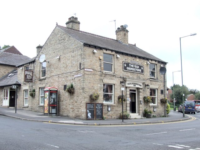
The Old Grindstone, Crookes
Introduction
The photograph on this page of The Old Grindstone, Crookes by Dave Hitchborne as part of the Geograph project.
The Geograph project started in 2005 with the aim of publishing, organising and preserving representative images for every square kilometre of Great Britain, Ireland and the Isle of Man.
There are currently over 7.5m images from over 14,400 individuals and you can help contribute to the project by visiting https://www.geograph.org.uk

Image: © Dave Hitchborne Taken: 26 Aug 2008
...but not the original. The Old Original Grindstone was across the road, about where the building is behind the tree. I have no history of The Old Grindstone, or the Original, but if anything becomes known, I will update this. The road left leads to Crosspool and the A57. The road right carries on up to Crookes, Walkley and Hillsborough. I photographed this pub back in 1968 and did a pen and ink drawing of it in 1976, which you can see here, much reduced in size from 7100x5000 - http://i14.photobucket.com/albums/a303/escafeld01/Misc/OLDGRINDSTONE-LINEDRAWINGb.jpg NOTE - I retain the copyright for the drawing.

