Yeovil Hundred Stone
Introduction
The photograph on this page of Yeovil Hundred Stone by Nigel Mykura as part of the Geograph project.
The Geograph project started in 2005 with the aim of publishing, organising and preserving representative images for every square kilometre of Great Britain, Ireland and the Isle of Man.

There are currently over 7.5m images from over 14,400 individuals and you can help contribute to the project by visiting https://www.geograph.org.uk
Yeovil Hundred Stone
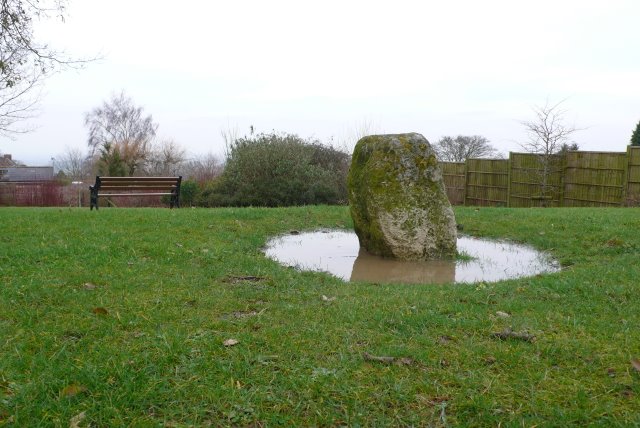
Image: © Nigel Mykura Taken: 31 Jan 2009
The Yeovil Hundred Stone according to difference references is either the meeting place of the men from the hundred ( a Saxon administrative area that contributed 100 men to the standing army), or it is the boundary stone where several hundreds meet. The lane along side is Stone Lane and the farm just to the north is Stone Farm
Images are licensed for reuse under creativecommons.org/licenses/by-sa/2.0
Image Location
Latitude
50.956919
Longitude
-2.633239