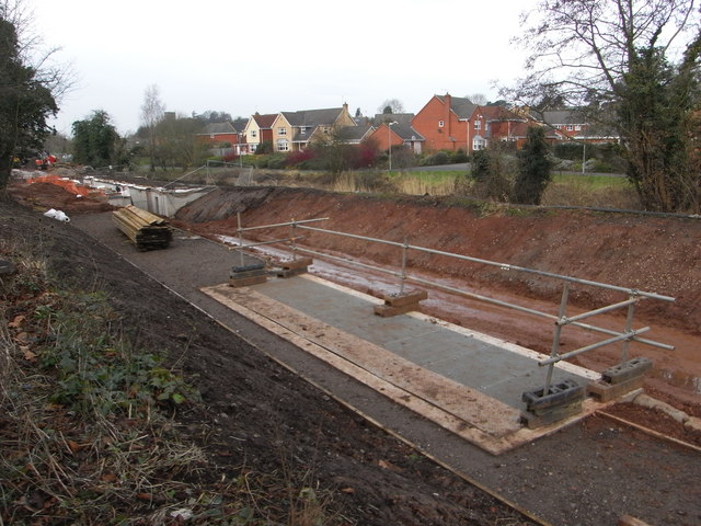
Droitwich Junction Canal - the bywash weir
Introduction
The photograph on this page of Droitwich Junction Canal - the bywash weir by Chris Allen as part of the Geograph project.
The Geograph project started in 2005 with the aim of publishing, organising and preserving representative images for every square kilometre of Great Britain, Ireland and the Isle of Man.
There are currently over 7.5m images from over 14,400 individuals and you can help contribute to the project by visiting https://www.geograph.org.uk

Image: © Chris Allen Taken: 31 Jan 2009
The structure in the foreground was long a mystery to me but Peter Lee's website - http://www.leepd60.110mb.com/ - has explained all. This is the bywash weir that supplies water to a long pipeline that connects the Junction Canal to the Barge Canal and bypasses the canalised section of the River Salwarpe. This apparently preserves water quality in the Salwarpe. Immediately next to the weir is the newly formed cut and there is a mooring wharf to the left of the weir. In the left background with bright orange netting is the nearly completed lock No. 7.

