Fire Station, Bury St. Edmunds
Introduction
The photograph on this page of Fire Station, Bury St. Edmunds by John Goldsmith as part of the Geograph project.
The Geograph project started in 2005 with the aim of publishing, organising and preserving representative images for every square kilometre of Great Britain, Ireland and the Isle of Man.

There are currently over 7.5m images from over 14,400 individuals and you can help contribute to the project by visiting https://www.geograph.org.uk
Fire Station, Bury St. Edmunds
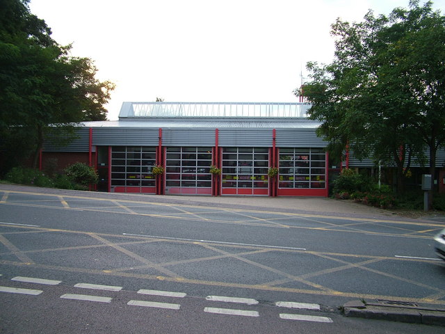
Image: © John Goldsmith Taken: 6 Sep 2008
Off Parkway. While this road provides good road access in most directions, the position at the bottom of a long hill seems odd, when sites could have been found at the top. This is at least the third Fire Station in Bury St. Edmunds - a town centre building still carries the carved stone marking. A later one in Fornham Road was demolished for housing. Note the decorative flower baskets - Bury is a repeat winner in the Britain In Bloom contest.
Images are licensed for reuse under creativecommons.org/licenses/by-sa/2.0
Image Location
Latitude
52.248781
Longitude
0.706995