The Millmount Road, Dundonald (1)
Introduction
The photograph on this page of The Millmount Road, Dundonald (1) by Albert Bridge as part of the Geograph project.
The Geograph project started in 2005 with the aim of publishing, organising and preserving representative images for every square kilometre of Great Britain, Ireland and the Isle of Man.

There are currently over 7.5m images from over 14,400 individuals and you can help contribute to the project by visiting https://www.geograph.org.uk
The Millmount Road, Dundonald (1)
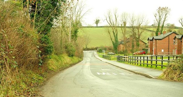
Image: © Albert Bridge Taken: 29 Jan 2009
The Millmount Road runs off the Comber Road (background) towards the main Belfast – Newtownards road. Back in 1963 the Matthew Plan envisaged a novelty which came to be known as the “Matthew Stop Line” ie a limit on the outward development of Belfast. It has not been taken too seriously. This photo shows the eastern limit of greater Belfast. Fields to the left and suburbs to the right. See also Image Image shows the road after stopping-up as part of the Millmount Village development.
Images are licensed for reuse under creativecommons.org/licenses/by-sa/2.0
Image Location
Latitude
54.581966
Longitude
-5.793332