View from Stafford Castle.
Introduction
The photograph on this page of View from Stafford Castle. by Simon Huguet as part of the Geograph project.
The Geograph project started in 2005 with the aim of publishing, organising and preserving representative images for every square kilometre of Great Britain, Ireland and the Isle of Man.

There are currently over 7.5m images from over 14,400 individuals and you can help contribute to the project by visiting https://www.geograph.org.uk
View from Stafford Castle.
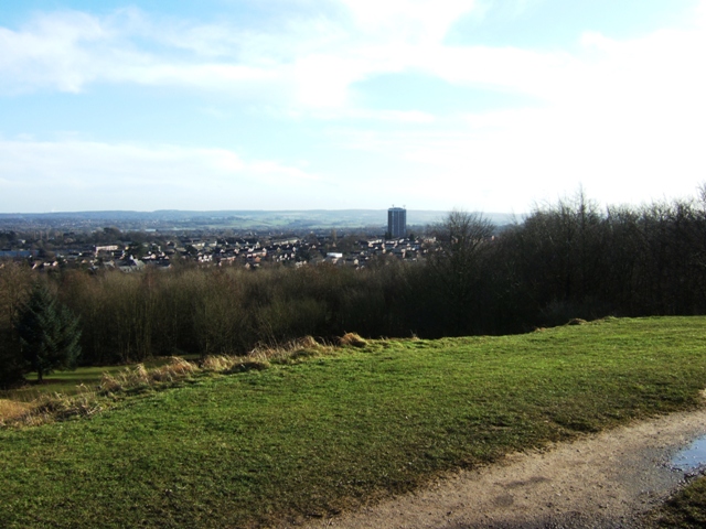
Image: © Simon Huguet Taken: 20 Jan 2009
On a clear day the all around views from the motte of Stafford's castle make the steep climb well worth it. This picture shows part of the inner bailey and the tree filled bank and ditch between it and the outer bailey. The Western Downs suburb of Stafford lies in the middleground and the far horizon is Cannock Chase.
Images are licensed for reuse under creativecommons.org/licenses/by-sa/2.0
Image Location
Latitude
52.796377
Longitude
-2.143074