Village of Kenmore
Introduction
The photograph on this page of Village of Kenmore by ronnie leask as part of the Geograph project.
The Geograph project started in 2005 with the aim of publishing, organising and preserving representative images for every square kilometre of Great Britain, Ireland and the Isle of Man.

There are currently over 7.5m images from over 14,400 individuals and you can help contribute to the project by visiting https://www.geograph.org.uk
Village of Kenmore
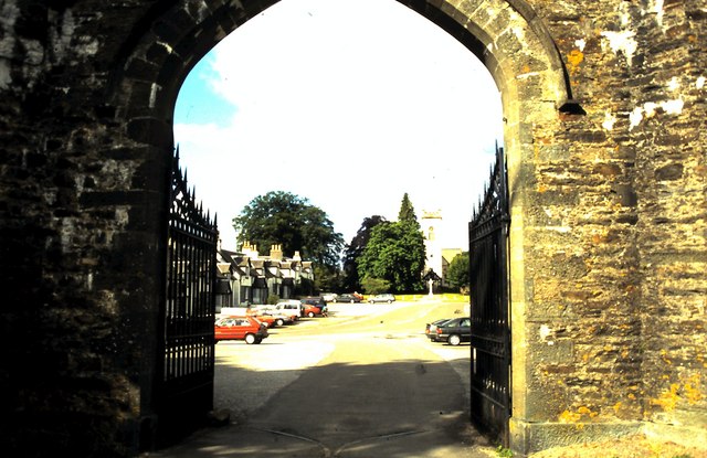
Image: © ronnie leask Taken: 15 May 1994
View from the entrance gateway to Taymouth Castle, once the seat of the Marquis of Breadalbane. Kenmore is a very attractive and well kept village at the east of Loch Tay. The present village was laid out by the 3rd Earl of Breadalbane in 1760. He let the inhabitants live rent free on condition that they followed a trade and kept the place clean and tidy. This generous arrangement cut both ways since it ensured he had a core of tradesmen at his bidding! Burns was favourably impressed when he stayed at the Inn during his highland tour and penned some suitable lines.
Images are licensed for reuse under creativecommons.org/licenses/by-sa/2.0
Image Location
Latitude
56.584593
Longitude
-3.999978