Worthenbury village hall
Introduction
The photograph on this page of Worthenbury village hall by John S Turner as part of the Geograph project.
The Geograph project started in 2005 with the aim of publishing, organising and preserving representative images for every square kilometre of Great Britain, Ireland and the Isle of Man.

There are currently over 7.5m images from over 14,400 individuals and you can help contribute to the project by visiting https://www.geograph.org.uk
Worthenbury village hall
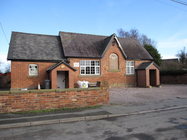
Image: © John S Turner Taken: 17 Jan 2009
The village hall is located in Church Lane across the way from the church. According to the 1881 O.S. map the building was once the National School for Boys and Girls.
Images are licensed for reuse under creativecommons.org/licenses/by-sa/2.0
Image Location
Latitude
53.009856
Longitude
-2.866623