
West End Green and West End Lane
Introduction
The photograph on this page of West End Green and West End Lane by Natasha Ceridwen de Chroustchoff as part of the Geograph project.
The Geograph project started in 2005 with the aim of publishing, organising and preserving representative images for every square kilometre of Great Britain, Ireland and the Isle of Man.

There are currently over 7.5m images from over 14,400 individuals and you can help contribute to the project by visiting https://www.geograph.org.uk
West End Green and West End Lane
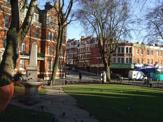
Image: © Natasha Ceridwen de Chroustchoff Taken: 6 Jan 2009
A small grassy area at the hub of several roads is all that remains of what must have been, centuries ago, a peaceful woodland clearing criss-crossed by paths running between country estates. During the Middle Ages a few large houses and farms were built in the area and by 1800 West End was a hamlet of cottages and seats set in parkland. In 1812 James Leigh Hunt moved to West End, attracted by a district so quiet that the inhabitants of West End Hall claimed to have heard the cannon at Waterloo, according to URL: http://www.british-history.ac.uk/report.aspx?compid=22636 Serious development was hastened by the local arrival of three railway lines during the second half of the C19, with the building of residential streets with small houses for artisans and minor professionals. Now the green hosts a colony of pigeons and rather too many dogs doing their their duties. Opposite in the image is the foot of West End Lane rising towards its junction with Finchley Road.
Images are licensed for reuse under creativecommons.org/licenses/by-sa/2.0
Image Location

Latitude
51.552463
Longitude
-0.191563