Signpost at Long Common, Shropshire
Introduction
The photograph on this page of Signpost at Long Common, Shropshire by Roger D Kidd as part of the Geograph project.
The Geograph project started in 2005 with the aim of publishing, organising and preserving representative images for every square kilometre of Great Britain, Ireland and the Isle of Man.

There are currently over 7.5m images from over 14,400 individuals and you can help contribute to the project by visiting https://www.geograph.org.uk
Signpost at Long Common, Shropshire
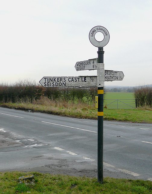
Image: © Roger D Kidd Taken: 21 Jan 2009
Not far from Seisdon in Staffordshire, and only into Shropshire by about three hundred metres, the arm pointing to Tinkers Castle appears to have corroded so much it fell off, and had to be riveted back on, with some fairly crude painted lettering. Wombourn is now almost always spelt Wombourne.
Images are licensed for reuse under creativecommons.org/licenses/by-sa/2.0
Image Location
Latitude
52.541221
Longitude
-2.263885