Sherburn-in-Elmet station
Introduction
The photograph on this page of Sherburn-in-Elmet station by John Armitstead as part of the Geograph project.
The Geograph project started in 2005 with the aim of publishing, organising and preserving representative images for every square kilometre of Great Britain, Ireland and the Isle of Man.

There are currently over 7.5m images from over 14,400 individuals and you can help contribute to the project by visiting https://www.geograph.org.uk
Sherburn-in-Elmet station
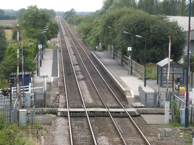
Image: © John Armitstead Taken: 28 Aug 2007
A view of the station taken from the road overbridge. The road used to cross the railway on the level, at the crossing visible on the photo. This level crossing remains for pedestrian use.
Images are licensed for reuse under creativecommons.org/licenses/by-sa/2.0
Image Location
Latitude
53.797692
Longitude
-1.232978