Lord Nelson Public House
Introduction
The photograph on this page of Lord Nelson Public House by Bryan Tenny as part of the Geograph project.
The Geograph project started in 2005 with the aim of publishing, organising and preserving representative images for every square kilometre of Great Britain, Ireland and the Isle of Man.

There are currently over 7.5m images from over 14,400 individuals and you can help contribute to the project by visiting https://www.geograph.org.uk
Lord Nelson Public House
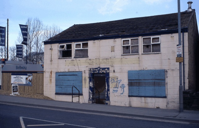
Image: © Bryan Tenny Taken: Unknown
A nineteenth century public house survived until around 2004/5 was demolished in 2008 and has now been replaced by a block of apartments.
Images are licensed for reuse under creativecommons.org/licenses/by-sa/2.0
Image Location
Latitude
53.61618
Longitude
-2.126185