Aerial view from top storey of The Atrium looking across Central Camberley (including Main Square)
Introduction
The photograph on this page of Aerial view from top storey of The Atrium looking across Central Camberley (including Main Square) by Roger as part of the Geograph project.
The Geograph project started in 2005 with the aim of publishing, organising and preserving representative images for every square kilometre of Great Britain, Ireland and the Isle of Man.

There are currently over 7.5m images from over 14,400 individuals and you can help contribute to the project by visiting https://www.geograph.org.uk
Aerial view from top storey of The Atrium looking across Central Camberley (including Main Square)
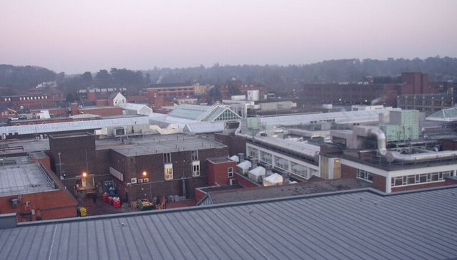
Image: © Roger Taken: 9 Jan 2009
With the opening of The Atrium leisure and shopping complex in late 2008, this photograph was taken from the top floor car park - and looks east across the town centre. It shows the roof of 'main square' an enclosed shopping centre, and a number of other buildings (with flat roofs) in nearby Park Street as an aerial view. Some distance beyond the town centre, can be seen plenty of woodland. (Despite this being at the very centre of Camberley, it is several miles from Frimley, by the way)
Images are licensed for reuse under creativecommons.org/licenses/by-sa/2.0
Image Location
Latitude
51.337689
Longitude
-0.746431