Wanderlust Way
Introduction
The photograph on this page of Wanderlust Way by Richard Croft as part of the Geograph project.
The Geograph project started in 2005 with the aim of publishing, organising and preserving representative images for every square kilometre of Great Britain, Ireland and the Isle of Man.

There are currently over 7.5m images from over 14,400 individuals and you can help contribute to the project by visiting https://www.geograph.org.uk
Wanderlust Way
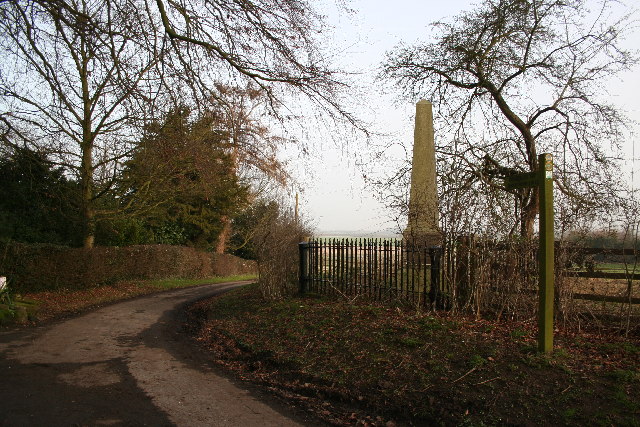
Image: © Richard Croft Taken: 24 Jan 2006
The signpost points northwards along the "Wanderlust Way". The obelisk is a monument to William Shaw of Brocklesby .. the plaque reads 'This monument was erected by his many friends as a token of their regard and to mark the spot where William Smith, huntsman to the Earl of Yarborough fell on 11th April 1845. His gallant horsemanship and management of hounds in the kennel and in the field were unsurpassed. His horse falling over a small leap whilst Smith was cheering on his favourite hounds, he was thrown on his head and from the injuries he then received, he died on 16th April 1845 at the house of his friend Richard Nainby of this village esquire, by whom the site for this memorial was given on the 6th day of April 1861'
Images are licensed for reuse under creativecommons.org/licenses/by-sa/2.0
Image Location
Latitude
53.512758
Longitude
-0.13753