The Greyhound roundabout, Ash, Surrey
Introduction
The photograph on this page of The Greyhound roundabout, Ash, Surrey by Humphrey Bolton as part of the Geograph project.
The Geograph project started in 2005 with the aim of publishing, organising and preserving representative images for every square kilometre of Great Britain, Ireland and the Isle of Man.

There are currently over 7.5m images from over 14,400 individuals and you can help contribute to the project by visiting https://www.geograph.org.uk
The Greyhound roundabout, Ash, Surrey
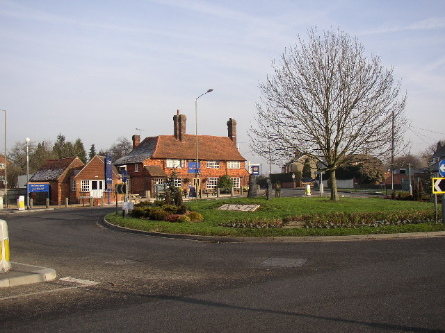
Image: © Humphrey Bolton Taken: 24 Jan 2006
This roundabout welcomes drivers to Ash, looking from the west. In the centre are a group of standing stones, presumably commemorating something? The Greyhound is a very old timber-framed building and was the first pub in the village. The greyhound name comes from the coat-of-arms of the Gaynesford family of Poyle Manor, to the south not far away.
Images are licensed for reuse under creativecommons.org/licenses/by-sa/2.0
Image Location
Latitude
51.244074
Longitude
-0.729206