Converted station, Llandre
Introduction
The photograph on this page of Converted station, Llandre by Nigel Brown as part of the Geograph project.
The Geograph project started in 2005 with the aim of publishing, organising and preserving representative images for every square kilometre of Great Britain, Ireland and the Isle of Man.

There are currently over 7.5m images from over 14,400 individuals and you can help contribute to the project by visiting https://www.geograph.org.uk
Converted station, Llandre
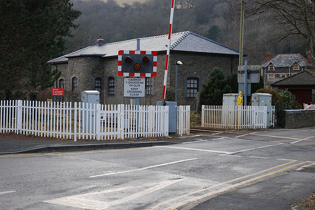
Image: © Nigel Brown Taken: 7 Jan 2009
Originally called Llanfihangel (or Llanvihangel in the Anglicised spelling) after the local village of Llanfihangel Gen'eur Glyn, the name was changed to Llandre in 1916 to avoid confusion with other Llanfihangel stations. The name of the village also changed to Llandre. Such was the power of the railway! After closure of the station (but not the railway) in 1965, it lay unused for many years, until sold and converted into a dwelling, of a rather more attractive appearance than the somewhat spartan original.
Images are licensed for reuse under creativecommons.org/licenses/by-sa/2.0
Image Location
Latitude
52.46197
Longitude
-4.024831