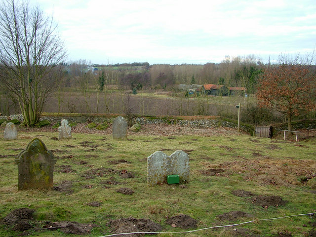
Farm buildings viewed from Creeting St. Mary churchyard
Introduction
The photograph on this page of Farm buildings viewed from Creeting St. Mary churchyard by John Goldsmith as part of the Geograph project.
The Geograph project started in 2005 with the aim of publishing, organising and preserving representative images for every square kilometre of Great Britain, Ireland and the Isle of Man.
There are currently over 7.5m images from over 14,400 individuals and you can help contribute to the project by visiting https://www.geograph.org.uk

Image: © John Goldsmith Taken: 2 Jan 2009
Also visible beyond the small smoke cloud is the A14, East Anglia's major east-west route. The church, on its hill-top site, is clearly visible from that road. A minor road is located just beyond the churchyard wall. The white line across the foreground is a wire forming part of some very low budget floodlighting.

