Hooley Lane
Introduction
The photograph on this page of Hooley Lane by Ian Capper as part of the Geograph project.
The Geograph project started in 2005 with the aim of publishing, organising and preserving representative images for every square kilometre of Great Britain, Ireland and the Isle of Man.

There are currently over 7.5m images from over 14,400 individuals and you can help contribute to the project by visiting https://www.geograph.org.uk
Hooley Lane
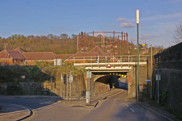
Image: © Ian Capper Taken: 17 Apr 2008
Prior to the current A25 being built from by Redhill Station up Redstone Hill in the 19th century, the route from Reigate eastwards came this way. The railway bridge carries the Brighton railway, and has four tracks at this point, the old route through Redhill Station and the bypass "Quarry Line" having joined at Earlswood Junction a few yards to the north. The blue cycle route sign is for National Cycle Network route 21, which passes through Redhill en route from Croydon to Gatwick.
Images are licensed for reuse under creativecommons.org/licenses/by-sa/2.0
Image Location
Latitude
51.232473
Longitude
-0.169845