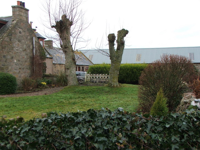
Lady Douglas's Grave
Introduction
The photograph on this page of Lady Douglas's Grave by Alison Mack as part of the Geograph project.
The Geograph project started in 2005 with the aim of publishing, organising and preserving representative images for every square kilometre of Great Britain, Ireland and the Isle of Man.
There are currently over 7.5m images from over 14,400 individuals and you can help contribute to the project by visiting https://www.geograph.org.uk

Image: © Alison Mack Taken: 2 Jan 2009
This grave is at Douglashead Farm. Alison's father remembers from his childhood in the area a story that it is the grave of a Lady Douglas who was captured and beheaded here. Aberdeenshire Council's Sites and Monuments Record corroborates this, indicating "...traditionally a Lady Douglas was pursued & killed by soldiers during a rebellion & buried here; grave enclosed by iron railings." [see http://www.aberdeenshire.gov.uk/archaeology/smr/smr_recdetails.asp?Rno=NJ83SE0041&curpage=2&RefNo=&Name=&Mapsheet=&Period=*&Typ=GRAVES&Typ2=&Typ3=&Parish=* ]. A quick web search does not indicate any clues as to which Lady Douglas and what rebellion is being referred to so any further background information would be very welcome.

