Historic boating
Introduction
The photograph on this page of Historic boating by David Long as part of the Geograph project.
The Geograph project started in 2005 with the aim of publishing, organising and preserving representative images for every square kilometre of Great Britain, Ireland and the Isle of Man.

There are currently over 7.5m images from over 14,400 individuals and you can help contribute to the project by visiting https://www.geograph.org.uk
Historic boating
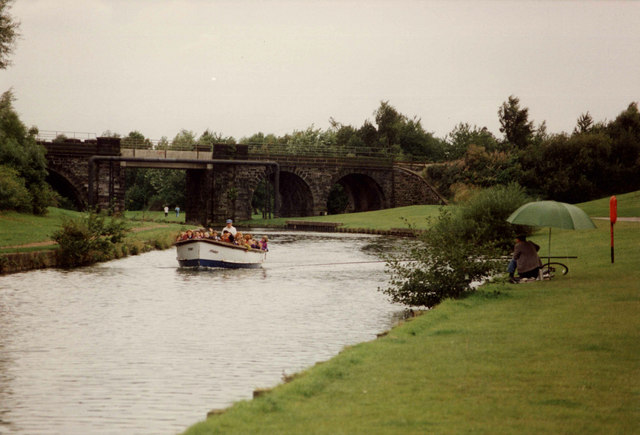
Image: © David Long Taken: Unknown
The ST HELEN north of the 7 arches viaduct. The square section of the platform over the canal is markedly different from the other arches. Further upstream Stephenson's 9 arch Earlestown Viaduct had to be built 70' high to allow the high-master Mersey sailing flats to pass beneath. It is assumed that here there was a moveable section over the canal to allow the same facility, but no details of it seem to exist.
Images are licensed for reuse under creativecommons.org/licenses/by-sa/2.0
Image Location
Latitude
53.39722
Longitude
-2.617306