Site of railway swing bridge
Introduction
The photograph on this page of Site of railway swing bridge by David Long as part of the Geograph project.
The Geograph project started in 2005 with the aim of publishing, organising and preserving representative images for every square kilometre of Great Britain, Ireland and the Isle of Man.

There are currently over 7.5m images from over 14,400 individuals and you can help contribute to the project by visiting https://www.geograph.org.uk
Site of railway swing bridge
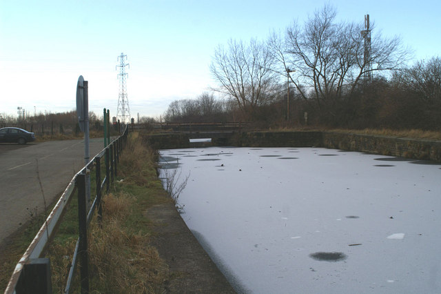
Image: © David Long Taken: 2 Jan 2009
The Warrington-Garston line originally crossed the Sankey Canal by means of a swing bridge, which became fixed after the canal was officially abandoned in 1963. The canal had priority, which meant the bridge was swung over in its favour at night. This led to a locomotive, off route, plunging into the water in November 1858.
Images are licensed for reuse under creativecommons.org/licenses/by-sa/2.0
Image Location
Latitude
53.38333
Longitude
-2.626426