Wayneflete's Tower
Introduction
The photograph on this page of Wayneflete's Tower by Walter Koscielniak as part of the Geograph project.
The Geograph project started in 2005 with the aim of publishing, organising and preserving representative images for every square kilometre of Great Britain, Ireland and the Isle of Man.

There are currently over 7.5m images from over 14,400 individuals and you can help contribute to the project by visiting https://www.geograph.org.uk
Wayneflete's Tower
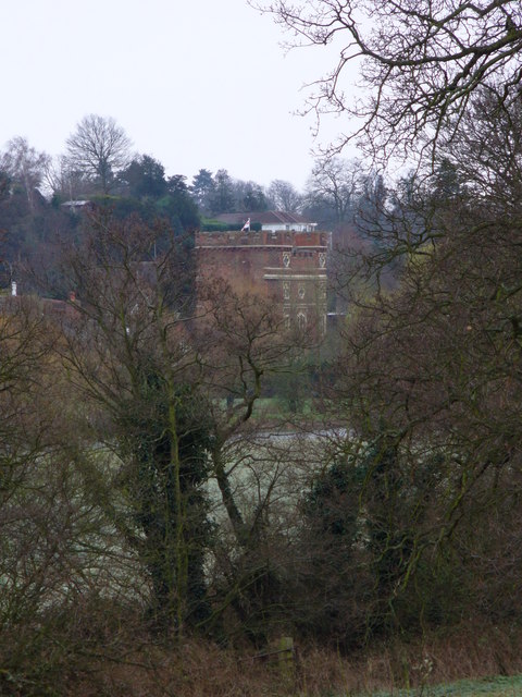
Image: © Walter Koscielniak Taken: 23 Mar 2008
Wayneflete's Tower was originally an 11th century manorial complex, sited on the banks of the River Mole. In 1462, Bishop William Waynflete of Winchester, founded the brick Palace of Esher and incorporated the medieval stone fortified manor house. The four storey gatehouse, with semi-octagonal turrets to the fore, was linked by a high curtain wall to a huge brick keep, which had octagonal turrets on the angles. Sadly in 17th century, the keep, the great hall, the curtain wall and associated building ranges were all demolished, down to the foundations. In the 18th century, Henry Pelham added a pair of wings and a porch, when integrating the tower into a Gothic mansion house.
Images are licensed for reuse under creativecommons.org/licenses/by-sa/2.0
Image Location
Latitude
51.373708
Longitude
-0.376922