The former Horsefair pub, 2 Stourbridge Road
Introduction
The photograph on this page of The former Horsefair pub, 2 Stourbridge Road by P L Chadwick as part of the Geograph project.
The Geograph project started in 2005 with the aim of publishing, organising and preserving representative images for every square kilometre of Great Britain, Ireland and the Isle of Man.

There are currently over 7.5m images from over 14,400 individuals and you can help contribute to the project by visiting https://www.geograph.org.uk
The former Horsefair pub, 2 Stourbridge Road
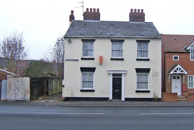
Image: © P L Chadwick Taken: 1 Jan 2009
Now residential accommodation, this was until a few years ago The Horsefair, one of the public houses in the Horsefair area. The area is one of several deprived areas in Kidderminster, but this one is now undergoing regeneration. Meanwhile the area has more than its fair share of problems. Which brings to mind something someone once wrote on the internet about Kidderminster pubs, "You need to know your pubs in Kiddy to avoid a black eye and a thick ear. Some are seriously rough. Get it wrong and it could hurt a lot...." That's probably sound advice and one or two of the town centre pubs, and those on the more run down estates, are probably best avoided. Another view of the former Horsefair: Image
Images are licensed for reuse under creativecommons.org/licenses/by-sa/2.0
Image Location
Latitude
52.392565
Longitude
-2.246097