Thatched shelter, Dunchurch
Introduction
The photograph on this page of Thatched shelter, Dunchurch by E Gammie as part of the Geograph project.
The Geograph project started in 2005 with the aim of publishing, organising and preserving representative images for every square kilometre of Great Britain, Ireland and the Isle of Man.

There are currently over 7.5m images from over 14,400 individuals and you can help contribute to the project by visiting https://www.geograph.org.uk
Thatched shelter, Dunchurch
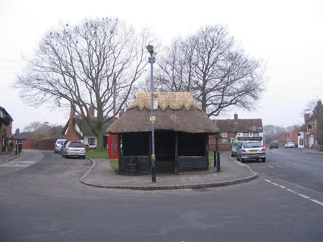
Image: © E Gammie Taken: 1 Jan 2009
The second thatched bus shelter I have come across*. This one at the heart of Dunchurch has had its ridge rethatched comparatively recently. Clever how that phone kiosk hangs from the eaves at the left. The road passing to the right is the former A45, and was before that the London-Holyhead coaching route. The schelter also serves as the village war memorial and both it and the K6 telephone kiosk to the left are grade II listed *Another thatched shelter: Image
Images are licensed for reuse under creativecommons.org/licenses/by-sa/2.0
Image Location
Latitude
52.337293
Longitude
-1.290628