River Harbourne Valley
Introduction
The photograph on this page of River Harbourne Valley by Adrian Platt as part of the Geograph project.
The Geograph project started in 2005 with the aim of publishing, organising and preserving representative images for every square kilometre of Great Britain, Ireland and the Isle of Man.

There are currently over 7.5m images from over 14,400 individuals and you can help contribute to the project by visiting https://www.geograph.org.uk
River Harbourne Valley
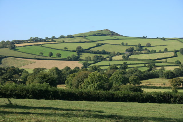
Image: © Adrian Platt Taken: 11 Sep 2007
The River Harbourne runs through the trees downstream from Zempston on the right towards Harbourneford to the left. The distinctive shape of Brent Hill, a local landmark, is seen on the skyline. The Hill, on the area known as Beara, has a cap of harder volcanic rock that has resisted erosion.
Images are licensed for reuse under creativecommons.org/licenses/by-sa/2.0
Image Location
Latitude
50.44984
Longitude
-3.809471