Burial Chamber
Introduction
The photograph on this page of Burial Chamber by Marion Phillips as part of the Geograph project.
The Geograph project started in 2005 with the aim of publishing, organising and preserving representative images for every square kilometre of Great Britain, Ireland and the Isle of Man.

There are currently over 7.5m images from over 14,400 individuals and you can help contribute to the project by visiting https://www.geograph.org.uk
Burial Chamber
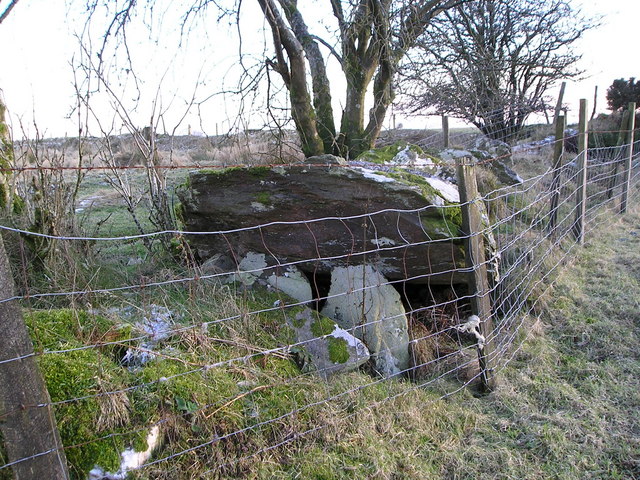
Image: © Marion Phillips Taken: 31 Dec 2008
I think this must be the burial chamber marked on the map. A large stone slab about 3 metres long is resting at this end on 3 upright flakes of stone. There are several other large stones lying around and the ground on the other side of the fence has hollows and hummocks, but it is difficult to understand what it all represents. There are no rights of way near here so I had to exercise my right to roam!
Images are licensed for reuse under creativecommons.org/licenses/by-sa/2.0
Image Location
Latitude
51.967751
Longitude
-4.36861