The Chenies
Introduction
The photograph on this page of The Chenies by Ian Capper as part of the Geograph project.
The Geograph project started in 2005 with the aim of publishing, organising and preserving representative images for every square kilometre of Great Britain, Ireland and the Isle of Man.

There are currently over 7.5m images from over 14,400 individuals and you can help contribute to the project by visiting https://www.geograph.org.uk
The Chenies
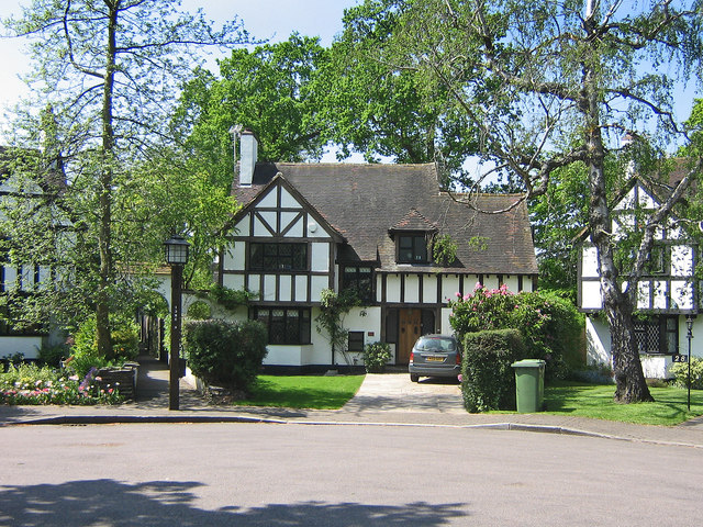
Image: © Ian Capper Taken: 6 May 2008
Various builders were involved in developing Petts Wood in the late 1920s/1930s, and provided they subscribed to the overall vision of Basil Scruby, the man behind the concept of Petts Wood as a green field "garden suburb", they were allowed to leave their individual mark. One of the best known builders involved was Noel Rees, typified by his "Tudor" style, and The Chenies is the pinnacle of his contribution. It is a private cul-de sac of 29 houses, each similar but different in style. In 1982 it was designated a Conservation Area. The name of the road comes from the village of the same name in Buckinghamshire, and was suggested by one of the first residents of the road who had moved in from that county. This is the end of the cul-de-sac, with the footpath through to Willett Way visible (see Image).
Images are licensed for reuse under creativecommons.org/licenses/by-sa/2.0
Image Location
Latitude
51.38778
Longitude
0.084677