The Barber Stone
Introduction
The photograph on this page of The Barber Stone by Jim Champion as part of the Geograph project.
The Geograph project started in 2005 with the aim of publishing, organising and preserving representative images for every square kilometre of Great Britain, Ireland and the Isle of Man.

There are currently over 7.5m images from over 14,400 individuals and you can help contribute to the project by visiting https://www.geograph.org.uk
The Barber Stone
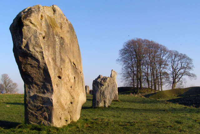
Image: © Jim Champion Taken: 29 Dec 2008
On the left is a sarsen standing stone (known as the Barber Stone) in the south-west quadrant of the Great Circle. The name comes from the human remains found underneath the stone when it was excavated by Alexander Keiller: from the tools and coins found with the body it is assumed that he was a 14th-century barber-surgeon. Most of the stones at the Avebury site were toppled and buried or broken up in the middle ages and some (such as the ones in this photograph) were re-erected in the 20th century. The beech trees in the distance are planted on the henge bank at the southern entrance to the henge, which now admits the A361 road.
Images are licensed for reuse under creativecommons.org/licenses/by-sa/2.0
Image Location
Latitude
51.427027
Longitude
-1.854393