The "Ski Jump" or the "Road to Nowhere", Glasgow
Introduction
The photograph on this page of The "Ski Jump" or the "Road to Nowhere", Glasgow by Stephen Sweeney as part of the Geograph project.
The Geograph project started in 2005 with the aim of publishing, organising and preserving representative images for every square kilometre of Great Britain, Ireland and the Isle of Man.

There are currently over 7.5m images from over 14,400 individuals and you can help contribute to the project by visiting https://www.geograph.org.uk
The "Ski Jump" or the "Road to Nowhere", Glasgow
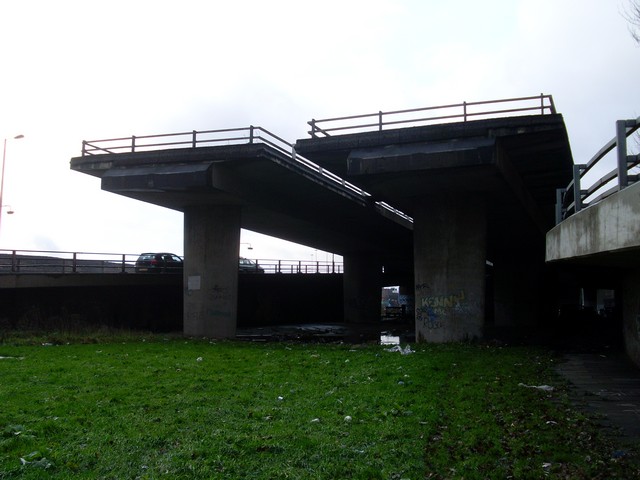
Image: © Stephen Sweeney Taken: 18 Dec 2008
An incomplete part of the Glasgow Inner Ring Road. Anyone looking at a map of Glasgow City Centre will see that the M8 boxes in the city on the west and north sides. This "box" was to be completed by a Ring Road on the east and south sides, but work on the ring road was abandoned in 1972, leaving several roads and bridges to nowhere around the city. This one in Kingston in the South Side was to connect up to the M74, which currently termninates at Carmyle. In 2008 work started on the extension of the M74, but it will now meet the M8 just south of this point. A proposal has been made for a bypass in the East End of the city, which will connect the M8 and M74 via Parkhead and to some extent complete the abandoned Inner City Ring Road.
Images are licensed for reuse under creativecommons.org/licenses/by-sa/2.0
Image Location
Latitude
55.851892
Longitude
-4.266358