Greenway
Introduction
The photograph on this page of Greenway by John Davies as part of the Geograph project.
The Geograph project started in 2005 with the aim of publishing, organising and preserving representative images for every square kilometre of Great Britain, Ireland and the Isle of Man.

There are currently over 7.5m images from over 14,400 individuals and you can help contribute to the project by visiting https://www.geograph.org.uk
Greenway
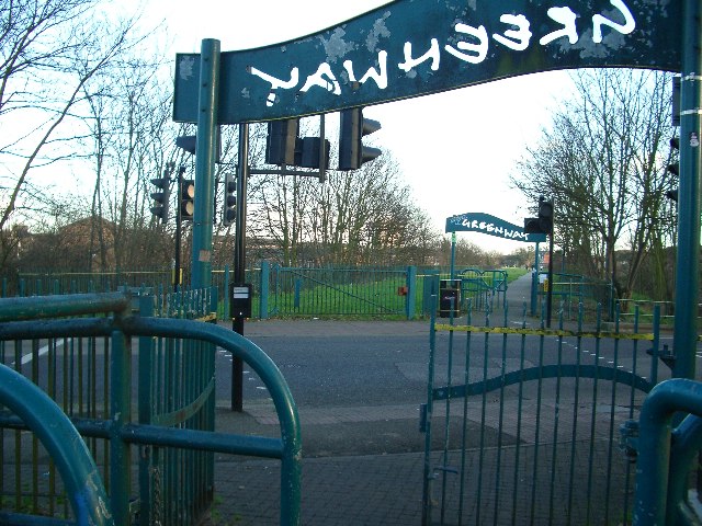
Image: © John Davies Taken: 21 Jan 2006
The Greenway provides a traffic-free walking and cycling route for a few miles through one of the most densely populated areas of east London. It runs from the Old Ford to Becton, over the top of the Northern Outfall Sewer. The many road crossings are protected with lights and are gated to prevent motorised access. Here Greenway crosses Balaam Street, Plaistow.
Images are licensed for reuse under creativecommons.org/licenses/by-sa/2.0
Image Location
Latitude
51.525817
Longitude
0.019586