Lewes Road
Introduction
The photograph on this page of Lewes Road by Simon Carey as part of the Geograph project.
The Geograph project started in 2005 with the aim of publishing, organising and preserving representative images for every square kilometre of Great Britain, Ireland and the Isle of Man.

There are currently over 7.5m images from over 14,400 individuals and you can help contribute to the project by visiting https://www.geograph.org.uk
Lewes Road
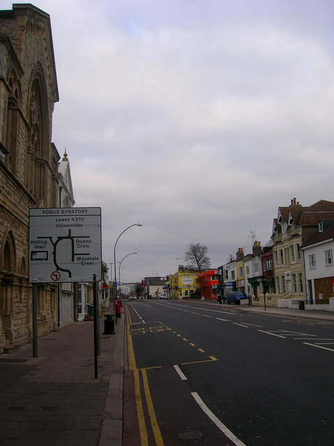
Image: © Simon Carey Taken: 25 Dec 2008
Formerly the A27 it has been the A270 since the construction of the Brighton by-pass in the early 1990s. This is the approach to the traffic system known as the Vogue Gyratory which links Lewes Road and Upper Lewes Road with two other minor but busy routes, Hollingdean Road and Bear Road. It is one of the most confusing road junctions in Brighton. Until 1976 the view would also have taken in Lewes Road viaduct which carried the Kemp Town branch over this road between 1869-1971 when the line was closed. The orange building on the right marks the spot where it crossed.
Images are licensed for reuse under creativecommons.org/licenses/by-sa/2.0
Image Location
Latitude
50.835946
Longitude
-0.125524