Cymric Mill
Introduction
The photograph on this page of Cymric Mill by Penny Mayes as part of the Geograph project.
The Geograph project started in 2005 with the aim of publishing, organising and preserving representative images for every square kilometre of Great Britain, Ireland and the Isle of Man.

There are currently over 7.5m images from over 14,400 individuals and you can help contribute to the project by visiting https://www.geograph.org.uk
Cymric Mill
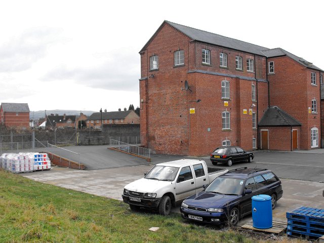
Image: © Penny Mayes Taken: 25 Dec 2008
Once a flannel mill, it has been converted into residential apartments. It stands between Canal Road and the River Severn on the eastern outskirts of Newtown. The Montgomery Canal used to lie between the mill and the river, terminating in a basin to the SW. The empty plot to the left of the building is the site of the much larger Commercial Mill.
Images are licensed for reuse under creativecommons.org/licenses/by-sa/2.0
Image Location
Latitude
52.518224
Longitude
-3.30523