The Church House Inn, Torbryan
Introduction
The photograph on this page of The Church House Inn, Torbryan by Paul Hutchinson as part of the Geograph project.
The Geograph project started in 2005 with the aim of publishing, organising and preserving representative images for every square kilometre of Great Britain, Ireland and the Isle of Man.

There are currently over 7.5m images from over 14,400 individuals and you can help contribute to the project by visiting https://www.geograph.org.uk
The Church House Inn, Torbryan
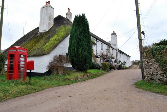
Image: © Paul Hutchinson Taken: 24 Dec 2008
To the southeast of Torbryan church (Image) lies the 13th century freehouse, The Church House Inn. The Building, erected by stonemasons in 1340, has over the centuries incorporated many features from different periods of English history. This unique, part-thatched Country Inn is a "Grade 2" listed building.
Images are licensed for reuse under creativecommons.org/licenses/by-sa/2.0
Image Location
Latitude
50.488736
Longitude
-3.664496